National Weather Service confirms tornado hit Dubois County

The National Weather Service has assessed the damage incurred by the storms which moved
through Dubois County on Friday, March 3, 2023.
NWS has concluded that the damage received in a 7.3-mile stretch from an area just west of Huntingburg, moving northeast to the Grassland Hills area, resulted from an EF1 tornado with peak winds of 105 miles per hour. At its widest, the tornado’s path was about 400 yards wide.

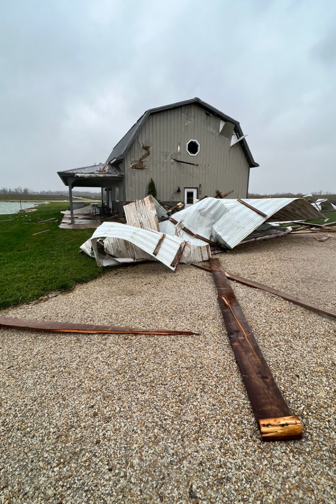
According to an update from the National Weather Service, an EF-1 tornado formed on the west side of Dubois County, embedded within a line of severe thunderstorms. It first touched down near a barn in the city of Duff, leaving only one wall and the area`s tornado siren standing.
The tornado then crossed flat farmland, not causing noticeable damage again until it reached the corner of county roads 450 West and 100 South, where a barn had significant roof damage and a home had shingle and siding damage. A private citizen shared video footage of a narrow condensation funnel looking toward this damage.
From here, a continuous path of damage was noted going through neighborhoods along Skyview Drive and Schuetter Drive west of Jasper. The tornado last caused damage in the Grassland Hills subdivision, causing multiple trees to snap near West 31st Street At this point some tree top snapping was noted as the tornado lifted..
NWS thanked the Dubois County Emergency Management Office for providing plenty of damage photos and for close coordination in finding this tornado`s damage path amidst other reports of damage from the gradient winds that occurred a little later in the afternoon

There were numerous other areas throughout Dubois County with storm damage that the NWS states were due to high straight-line winds. Emergency Management Director Tammy Humbert confirmed damage in Schnellville, Celestine and Holland and noted several trees down in Dubois.
Fortunately, there were no injuries reported. Humbert credits the area’s storm spotter for that. “We have a great group of weather spotters in the county so we were ready for what was coming,” she said.
NWS originally classified the tornado as an EF0 (winds up to 85 mph) but after review of more damage, they upgraded it to an EF1.