Beaver Lake levels don’t measure up for property owners
Jasper — A special meeting regarding the new lake levels at Beaver Lake is scheduled for Tuesday at 6:30 p.m. at the Habig Center Community Room.
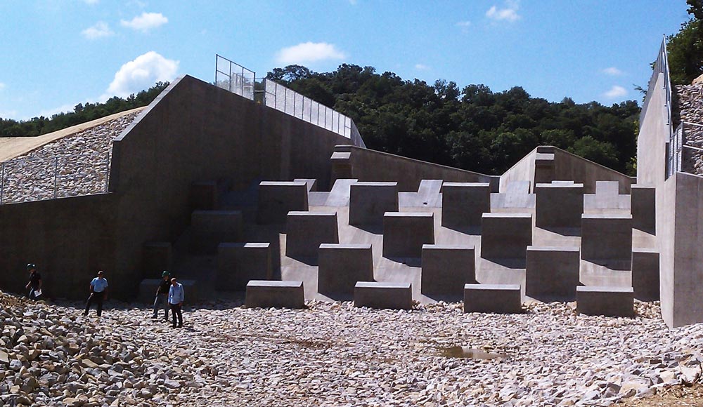
The dam renovation project replaced the original spillway which was about 25 feet wide, with a spillway 85 feet wide. The new spillway is designed to accommodate 26 inches of rain over eight hours — stopping water from rushing over the dam itself under what the Indiana Department of Natural Resources considers the area’s maximum possible precipitation.
Since the lake has refilled over the winter, residents and property owners around the lake have reported the level of the water is several inches lower than before the dam renovation project began.
In May, Brian McKenna, director of civil design for Christopher B. Burke Engineering of Indianapolis, appeared in front of the Jasper Utility Service Board to describe the possible reasons the water level is lower. Over 20 residents were in attendance at that meeting and offered commentary regarding the new lake level.

According to McKenna the spillway level is about half an inch lower than the original spillway, but the new design of the spillway has greatly affected the crest of the water in the lake. The crest is the height of the swell caused by the amount of water attempting to flow through the spillway at a given time.
McKenna explained to the board that the crest is a couple inches lower than it was with the original spillway. The crest may have been higher with the old spillway because of debris in the spillway as well as its narrower construction.
Residents and property owners disagree with McKenna’s statement the crest is only a few inches lower. Some have problems pulling up to their piers with boats; one resident is no longer able to pull his boat into a lift attached to their pier because the water level.
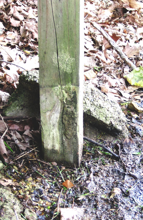
On some piers and decks, wooden piles that were originally in the water are on dry ground; the original water line clearly visible on the bumpers and wood.

During the utility service board meeting, Scott Messmer, a property owner since the 60s, told McKenna the information they were reporting was incorrect. “The only question is why is it incorrect,” said Messmer. “I can show you 20 different places where it is obvious the lake is lower.”
